
Confirmed landmarks
An airport, a football stadium, an amphitheatre, a military base and a fully explorable zoo, plus the towers and refineries that anchor each region.
Landmarks do more work in a Grand Theft Auto map than their size suggests. They're how people find their way without looking at the minimap, and how a map turns into a place you can describe to somebody else.
Confirmed across Leonida
- VCI Airport, named on an overhead highway sign in Trailer 2 and signposted off US 35 North. VCI is the obvious contraction of Vice City International.
- A football stadium
- An amphitheatre
- A military base
- A fully explorable zoo
The zoo's the one to stop on. Rockstar's built animals before, lots of them, in Red Dead Redemption 2. A zoo's a strange thing to make explorable unless something happens there.
The rest are big, recognisable shapes you'd expect to spot from a distance, which is exactly what you want from a landmark when you're trying to work out where you are.
Vice City's towers
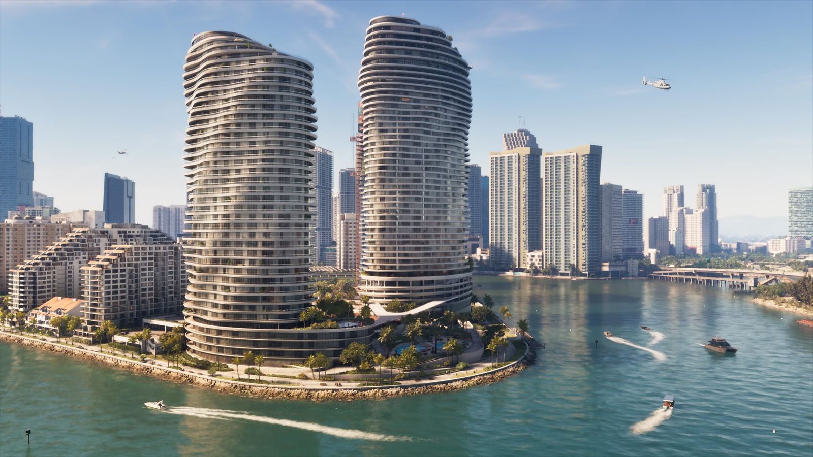
The Pagasi residences, a pair of curved waterfront towers with a third going up behind them, turn up in official material often enough to work as a fixed point for finding your way. The Megamundo building is used in the Extended Look's closing robbery.
Game Informer's September screenshots added another one you'd see from across the city: a lit big wheel down on the water, with searchlights sweeping the towers behind it. We went through all twelve of those shots. At street level, the Jack of Hearts is Boobie Ike's strip club, pink neon and all, and the Extended Look has a strip mall with Zeke's Gadgets and a dying video shop called Video Forever, the one Lucia robs, which we read sign by sign.
Elsewhere in the state
- Ambrosia is anchored by the Allied Crystal sugar refinery and sits next to Lake Leonida, the game's take on Lake Okeechobee.
- The Thrillbilly Mud Club looks to be in the same region, and it was first shown back in trailer one.
- The Rusty Anchor is the bar the Keys cast keeps turning up at.
- Port Gellhorn has the Starlet Motel and Delight's Cabaret, and you can read both signs in official screenshots. We've put Port Gellhorn about 200 miles up the coast from Vice City, but that's our estimate, and Rockstar hasn't given a distance.
- Out in the citrus country, a Game Informer screenshot has an orange-shaped water tower over a grove, and a pickup lettered Tucker's Citrus Farms, Since 1968. It's the first farm business anyone's been able to name.
- Another shows a state park waterfall with a wooden footbridge and people walking dogs across it. It's almost certainly Mount Kalaga, though Rockstar didn't caption it.
- And there's a biker bar with neon and a pool table, and club patches on every jacket.
Buses and trains between them
Edge's issue 430 cover feature, out on 29 October and written from a Rockstar demo, reports that buses and trains fully work, and that the team tested getting to Watson Bay by public transport alone. That's reported. If it holds, stations and stops become landmarks of their own, the places you'd tell somebody to meet you.
What isn't known
Of Rockstar's own list of five, only the airport has a name, and it took a road sign to get it. The stadium, the amphitheatre, the military base and the zoo are still unnamed. Rockstar hasn't said which landmarks you can go inside, which ones show up in missions, or where most of them sit in relation to each other. We don't know whether the big wheel runs, whether Tucker's Citrus Farms is a place or just a name on a truck, or where the train lines go.
This page is a list of what's been confirmed to exist. Individual entries will follow as Rockstar names them.
See also
Page history
- Fixed the infobox, which said only VCI Airport had a name, and added the Game Informer screenshot landmarks, the Jack of Hearts, the Extended Look strip mall, Port Gellhorn's distance and Edge's working buses and trains.